
3 posts tagged with "paragliding"

View All Tags

Helium Deployed: The Network In Action

· 12 min read
Nik
Site Owner

Our pilot project is complete, and boy have we learned a ton from this one! While many are still focusing on earning HNT for Helium Hotspot deployments, the obvious move for those of us interested in longevity is actually USING the Network.

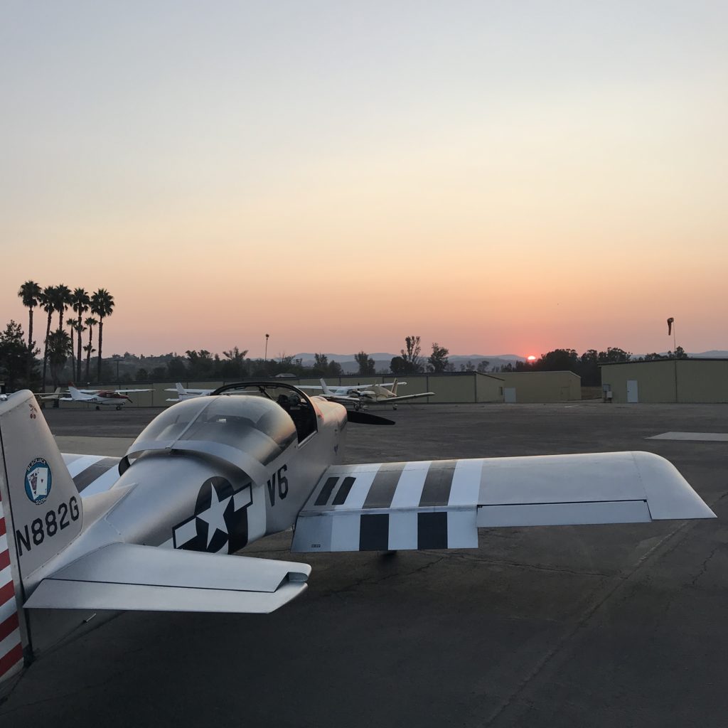
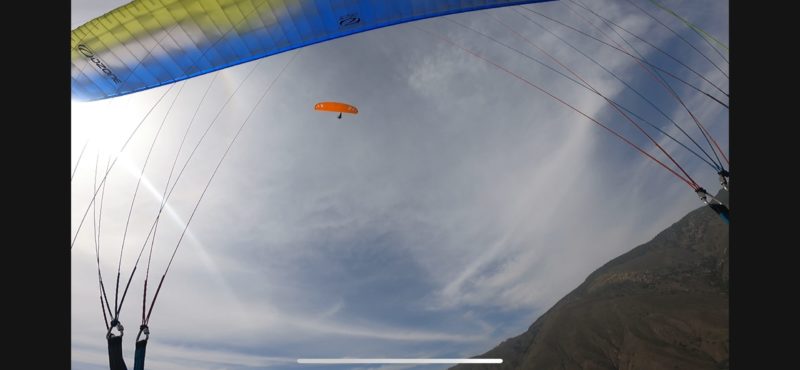
Over the course of a week, supported by Tommy and Ryan at Lonestar Tracking, Matthew at Digital Matter, Travis at Helium, and Jeremy C (@jerm on Discord), I deployed 2 off-grid Helium Hotspots high in the mountains of Utah (one at over 8,000' and one above 11,000') to track 30+ paragliders as they flew during the annual Red Rocks Fly In as well as raced during the inaugural X Red Rocks Hike & Fly race.

I've written about the prep for that here, as well as how paragliding got me into Helium. For now, let's follow along with what it looks like when you actually deploy Helium Hotspots for real world usage.

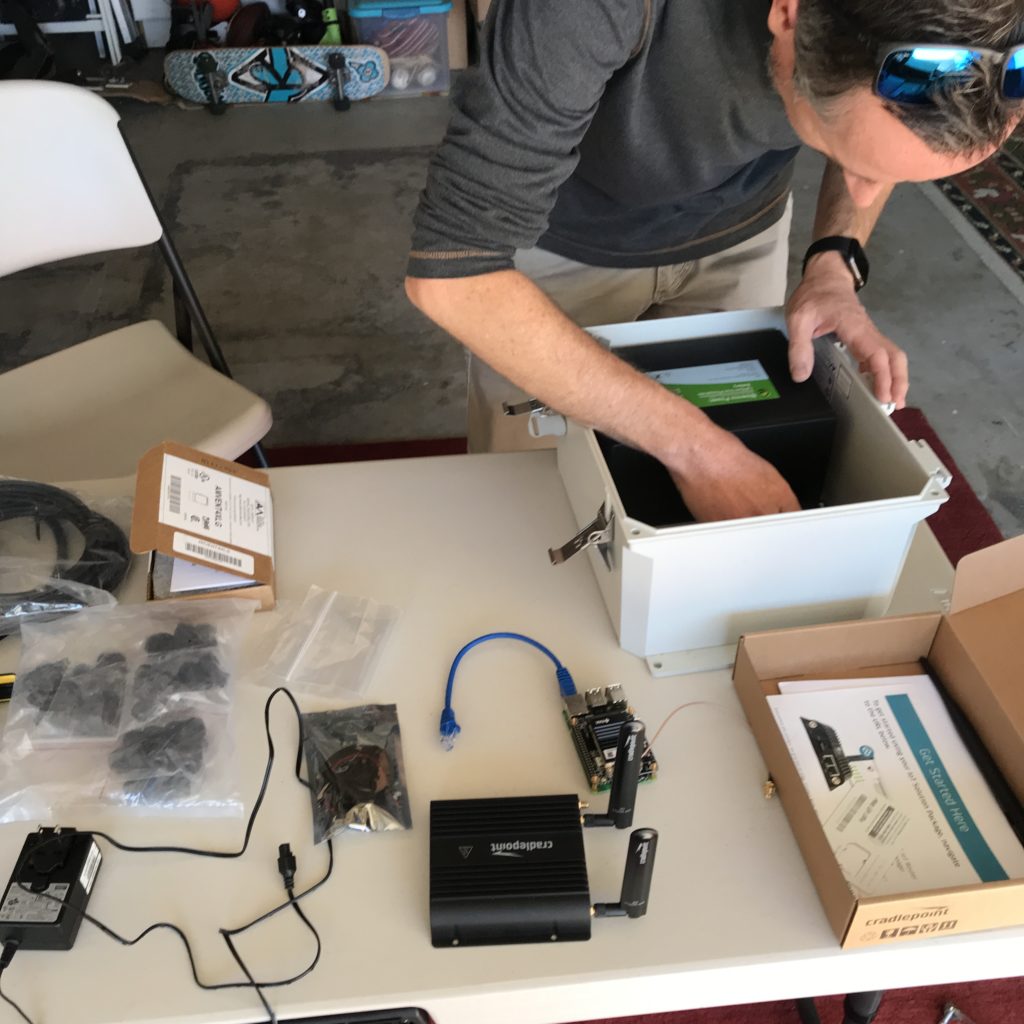
It started with the usual last minute scramble to get everything ready for a big project. The night before I was out in the shop cutting masts and prepping enclosures to make sure I had everything ready for a big week! During the past year, I've learned a bunch about getting these things out in the wild. The latest improvement I learned from a client (thanks Dave H!) was using these little tripods for a "plant it anywhere" setup that's easy to carry.

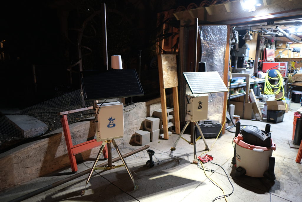
When you get where you're going, just fasten the tripods into the ground with long lag bolts and you're set!

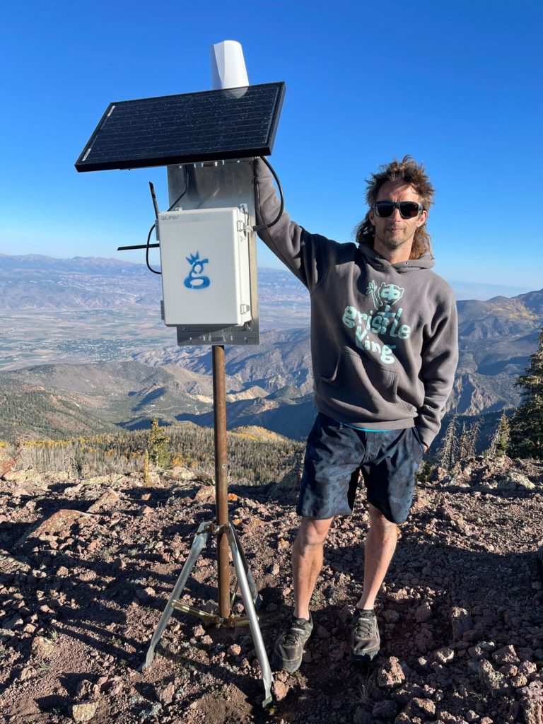
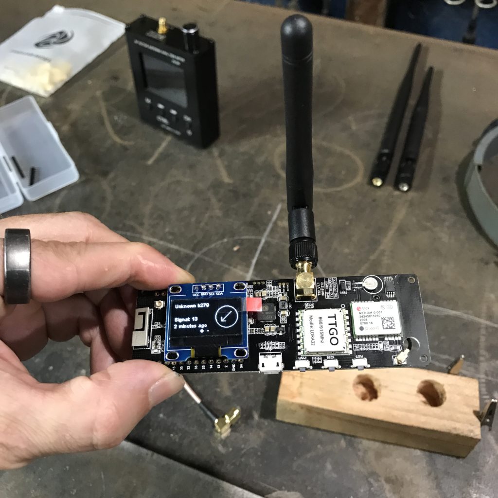
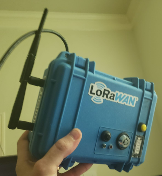
The trackers I used were Digital Matter Oyster trackers, about 160 grams and the size of a few phones stacked on top of each other. The advantages these trackers have is that there aren't any buttons to turn off or on, the battery life is measured from weeks to years, and they're pretty rugged. Originally designed to track vehicles, they were an excellent step in the direction of tracking far less predictable things. A paraglider has the entire sky within which to move.

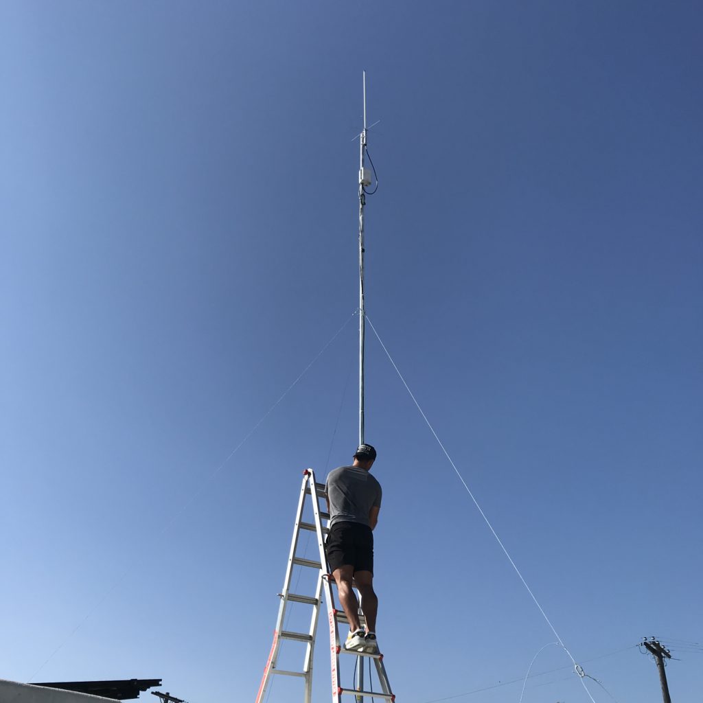
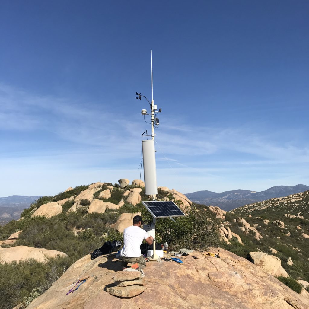
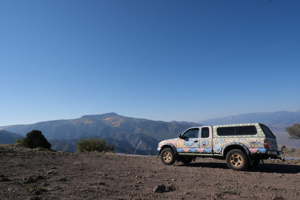
I arrived late Friday night into Monroe, Utah, then met up the next morning with Stacy Whitmore, president of the local flying club, CUASA. We jumped in my truck (which is pretty easy to pick out in a crowd) and headed up to place the two Helium Hotspots, one at Cove Launch, and one on top of Monroe Peak.

Cove was first up, and after a 40 minute drive up a rough road, we arrived at a truly glorious place to put a hotspot. With a view of the Sevier Valley to the north and south, it was an excellent first step.

https://youtu.be/qsoJ-\_zuxrU

As you can see in the video above, these 2 hotspots weren't the only ones providing coverage. Since pilots can get up to 18,000' (the legal limit) the trackers have a clear line of sight..everywhere. We were seeing 80+ mile sensor communication to the gateways, which is impressive!

With the gateways set up, it was time to start flying!

https://youtu.be/ijnTEm6Mrf8

As I handed out trackers to paragliders and watched their progress through the sky, a few things became clear.

First, the Network works. While the tech can be complicated and the whole thing is not yet push-a-button easy, it does work. That's rad.

Second, the deployment pattern of Hotspots becomes far more important when you start to optimize for Network coverage and not just earnings. I jumped at the first two locations because both were high and had great views. It worked, but there were plenty of coverage holes that I could've filled in with a different pattern. When I cover this event next year, I'll use 2 or 3 more hotspots and place them in a ring around the valley rather than on just one side. I'll also use Kudzu to estimate coverage, which was something I'd wanted to do but ran out of time.

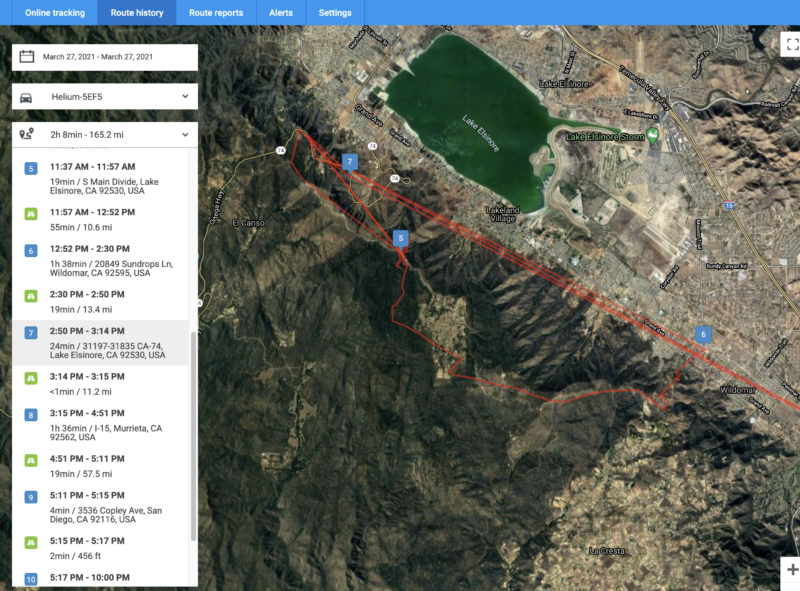
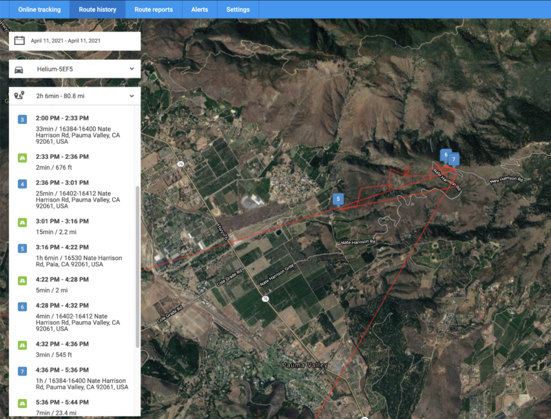
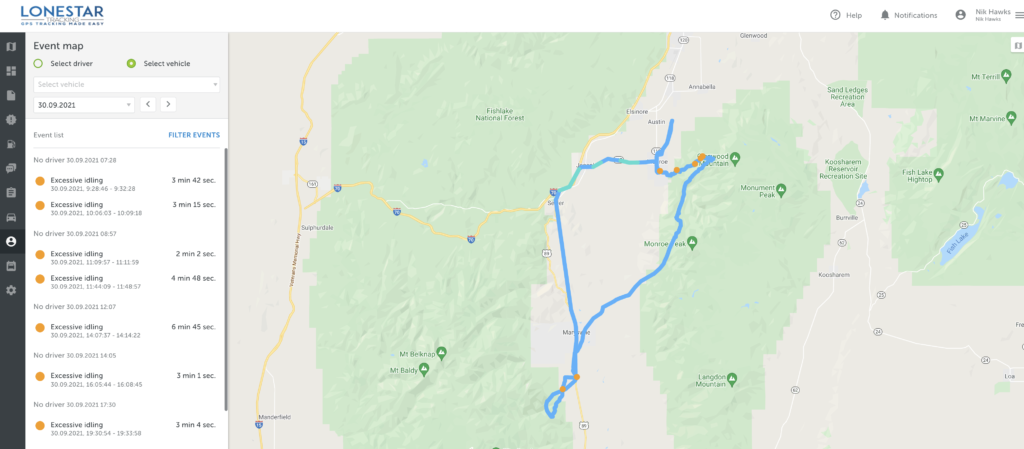
Third, using vehicle trackers to track paragliders is an excellent start, but free flight pilots in general (paraglider and hang gliders) need a few options that we hadn't configured in the trackers. Here's an example of the day in the life of a tracker, from the time I handed it out in the LZ (landing zone, which is where pilots in Monroe usually meet to start the day) all the way to the end of the day when the pilot went back to their hotel.

Before going further, I want to make it clear that this was a pilot program. This is NOT what the end product of a free flight tracker will look like. The goal of this project was to see what was possible and where we needed to improve.

Most of the improvements can come from better Hotspot placement and configuration settings within the tracker. Some improvements specific to free flight will come from hardware modifications. We started off with 2 minute intervals and eventually got 'em down to 30 second intervals by the end of the week. While that pushes out more *potential* data points, if you don't have coverage from a Hotspot it doesn't matter how much data your sensor is pushing out; it won't get seen.

A bunch of things can go wrong. The interval is important; if you set it for an hour you'll have a battery life measured in years, but for a 2 hour flight you'll only get 2 data points, like this:

Here's another pilot who did that same flight but had a tracker with much shorter intervals. You can see the difference it makes!

The configuration settings presented an additional set of challenges. For paragliding, I wanted a tracker that could be found if the pilot either had an emergency and landed conscious (and able to push a button), or landed and was unconscious. These trackers were set up for long battery life, so once they stopped moving for a period of time they went to sleep. That's very useful for tracking vehicles on land, but not very useful for paragliders flying in adventure country.

Keep in mind that these trackers only report their positions if they can communicate with a Hotspot. No Hotspot, no comms.

Going to sleep once movement has stopped presents the issue of not being able to be found if a pilot crashes and is unconscious or just not able to move. The solutions for solving that could be creating an on/off button for the tracker so that you can conserve battery at home, when you don't need to be tracked, but push out signals every 2 minutes when you go flying.

The rad aspect of creating off grid Helium Hotspots is that you could put a Hotspot in a helicopter and fly a search pattern with a very wide "bubble" of coverage. As long as trackers are on and pinging, you're very likely to find them. This creates another potential solution for "crash detection" in trackers where they'd continue to ping at 1 or 2 minute intervals if they detected a sudden stopping of movement.

Finally, this project brought to light the usefulness of an "emergency" button, just like you have on an inReach mini.

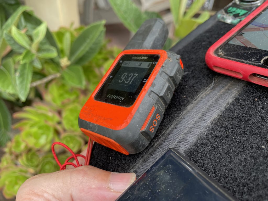
You might ask, "What's the point of having another device that does the same thing?" Well, there are three good reasons. First, when working in high consequence environments, a basic rule of safety is "Two is one and one is none." Having a backup can be the difference between being found within hours of a crash and not being found for days.

Second, because these two devices work using different technologies, they offer a wider spectrum of "findability." While an inReach can be found by communicating with satellites, if it's deep in a canyon and doesn't have a clear "view" of a satellite, it becomes less useful. A LoRa tracker, on the other hand, puts out an omnidirectional beacon at a minimum range of 60 meters in dense brush and a max range of 80+ miles with clear line of sight. A helo carrying a mobile Helium-compatible Hotspot can fly around and provide a bubble of fairly focused coverage, greatly speeding up the tracking possibilities.

Third, as gruesome as it sounds, if you auger in and hit hard, the impact is likely to break not only your bones but also the electronic tracking devices you're carrying. If those electronic devices are on opposite sides of your body, it is more likely that at least one of them will not bear the full force of the impact and will remain trackable. I know, ugly and terrible, but also practical.

Practicality is the watchword here. The long term health of the Network is based upon the usability of it. Projects like these, where we put sensors and gateways (Hotspots) out into the wild and see how they do, go a long way towards all of us leaning how to use this fantastically cool technology to improve our lives.

If you'd like to see the presentation I gave at the 2021 Red Rocks Fly In about Helium for paragliders, here it is:

https://www.youtube.com/watch?v=MsNQa0fL0WI

My entire involvement with Helium started with a lost paraglider, but finding lost paragliders is just a beginning. I am super pumped to be on this journey and to share as much as I can with you, so that together we can build a superbly useful tool for whatever problem you want to solve. Here's to safe flying, to useful Networks, and to advancing our knowledge and understanding that this giant new realm of IoT opportunity available to us all.

To life!

Resources

Feel free to reach out to any of these companies for help with your projects, and of course, tell 'em the Gristle King sent ya! :)

Lonestar Tracking - Based out of Texas, Lonestar makes it super easy to buy devices and start tracking whatever you'd like.

Digital Matter devices

Helium Network

CUASA - Central Utah Air Sports Association - If you have hotspots you want to place off grid, this crew is way open to having you put them up on high sites around the Sevier Valley. Reach out to Stacy or Jeff to see if you can work with them.

If you're looking for work in the Helium ecosystem, please check out this rad project I'm a part of called Helium Jobs. You can post and find jobs there, help support the ecosystem by making it easier to connect professionally, and let the world know that YOU exist and want to help contribute within the Network. Rock on!

Archived Comments

Mario - 10/10/2021

Inspiring. Dreaming of the day when I finish setting up my helium miners (for good) and start to think off, how can I, using Helium network, make other people's life easier/better. :)


Joseph Campos - 10/12/2021

Great job Nik! Your passion shows and it is awesome that it is aligned with helping keep people safe. Good job in the presentation video, you do a good job of explaining what can be a complicated subject sticking to the "why" the group would care.


Nik - 10/12/2021

Thanks Joseph, much appreciated!


Reports From The Field: Tracking With Helium - Gristle King - A Guide to Helium - 11/2/2021

[…] up was to pro­vide cus­tom track­ing for race par­tic­i­pants. Hav­ing recent­ly done the very first paraglid­ing track­ing event up in Utah, for the X Red Rocks race, I man­aged to avoid a few mis­takes, repeat a few more, and learn a […]


Precios Louzado - 11/8/2021

great job. Is it possible to integrate 3rd party appliances on helium devices as a hub for transacting on the blockchain.


Nik - 11/8/2021

You should be able to use just about any sensor. Helium maintains a list of "Helium ready" ones here.


Cody - 5/5/2022

You are doing incredible work Nik. Appreciate you sharing.


Nik - 5/6/2022

Thanks Cody!


Is Helium A Better "Last Chance"?

· 12 min read
Nik
Site Owner

I got into Helium accidentally. I was looking for a way to find and communicate with other paragliders out back of beyond. I had participated in a Search and Rescue for a well known paraglider out in remote Nevada at the end of summer 2020.

The missing paraglider pilot (James Johnston, aka Kiwi) had GPS and a cell phone, and it still took hundreds of people, including hunters, hikers, bike riders, ATV mounted search parties, planes, helicopters, drones, and satellite imagery 30 days to find him. Here's a 20 minute presentation on just the crowd-source satellite imagery side.

https://www.youtube.com/watch?v=2UgtrcyWreE

I flew up with my friend David Hunt in his small plane to help with the aerial search. We left early in the morning on the third day after Kiwi was reported missing and it became clear that the more people searching, the better.

We got bumped around in turbulent Nevada desert air for a few days before flying back to San Diego without having found the missing pilot. For almost the entire journey, David and I talked about better options for being found. Should we have a backup GPS, or was there another device or technology that could be useful? We found Recco Reflectors, which are useful if a local SAR crew has a helicopter with the technology, but...not many crews in the US have that.

Then another paraglider pilot and buddy of mine, Zach Armstrong, stumbled across this thing called LoRa. LoRa stands for LOng RAnge, and is the radio protocol used by Helium. As we searched around the internet for more on LoRa, we found two cool options. One was Meshtastic, a system designed by a paraglider that used LoRa to form mesh groups of communications nets. You and your buddies can all talk to each other across long distances using devices you build.

We built a couple devices and tested 'em out, thinking of them as a good option, but to be honest, pretty fiddly.

I found a way to 3D print cases locally, made a couple more devices and handed out my extras to local pilots to test while we flew in the mountains. They weren't easy to use unless you really like to tinker. Not everyone does.

Then I stumbled on Helium. It came up when you looked for "LoRa" back in August 2020 on the Googs. I'd been involved with crypto before, so I wasn't afraid of it and didn't think it was a scam. I saw a Helium "Hotspot" down the street from my house earning a tremendous amount of HNT, or Helium Network Tokens. That caught my attention. I got onto the Helium Discord back when you could read through every thread from the start in about a week and a half, and did just that.

Serendipitously, Helium opened up a DIY program at about the same time, where you could buy the parts to make your own Helium Hotspot and onboard it onto the Network. Along with my buddy TJ Ferrara, we applied for and received "alpha codes", then dug into how to actually use the things.

Here's TJ getting our first one online.

Here's TJ up on my roof, putting the finishing cable management touches on that first miner. We were so pumped to have one up and running!

Of course, I had to constantly tinker with it (it was all new and exciting), and the pole was too much for me to manage safely by myself, so I hooked my wife Lee up to the pole with a climbing harness and rope, and she patiently belayed the pole as I tilted it up and down to dial in the hotspot and antenna at the top. She's seen my many phases of crazy, and she gamely went along with this one.

Ok, so that got us into Helium, but how does that relate to paragliding?

Well, with our first hotspot done, I set my sights on getting an antenna way out in the mountains near my favorite paragliding spot. It'd provide us a way to test Helium Network coverage and see if we could use trackers to, well, track paragliders.

We started with Helium Tabs, but those left something to be desired. Form factor = cool, Performance = Not so much. I put one on my new bike and it managed to stop tracking within about a day.

I started ordering parts to build a giant off grid setup. I was so excited about the whole thing I'd send blow-by-blow videos to my Dad.

https://youtu.be/whRloJZ\_9RE

Guided by Paul over at Tourmaline Wireless, who drilled the holes and walked me through the layout, I got the first hotspot put together and ready to hike in. Here's Paul sussing out the best interior setup in his shop.

I got permission to place the thing on a mountain the backcountry of San Diego, then TJ & I hiked in 60+ lb backpacks filled with gear and set the thing up. Fun, and unfun. It was a giant antenna that I didn't need, plus more solar panel and battery than was necessary, but it was my first one. I ended up having to dial the antenna gain down with software, a project that introduced to some really cool and competent people (looking at you, @jerm on Discord), and it taught me a lot about what you actually want in an antenna vs what looks cool.

With the off grid hotspot in place and providing coverage from the Mexican border up to north of Los Angeles, I figured we could start testing tracking, but I needed more rugged tracking devices. I turned to Lonestar Tracking and bought a few Digital Matter Oysters from them along with a tracking subscription plan.

I handed out the devices to local paragliders, and we tested them. They worked (I've written about these tests over here.)

So that brings us now, October 2021, a year after the Kiwi SAR, to the Red Rocks Fly In and the XRed Rocks. The Fly In is an annual gathering of paragliding and hang gliding pilots, over 300 of us! It happens up in Monroe, Utah, and is a week of sharing the skies with other free flight enthusiasts. This year, there's something new: The X Red Rocks.

X Red Rocks (XRR) is a paragliding "hike and fly" race organized by one of my free flight heroes, Gavin McClurg. Gavin has participated in the super gnarly hike and fly race called the The Red Bull X Alps, held in (you guessed it) the Alps. He wanted to share that joy (and the joy of type 2 and 3 fun) with the rest of us back here in the US, so he put together the XRR.

In fact, it was Gavin's movie, The Rocky Mountains Traverse, that got me into paragliding back in 2016.

Unlike the month long journey that Gavin went on, the XRR is a 3 day event where, each day you hike up into the mountains to a launch with your paraglider, unpack, unfold, and launch off the mountain, fly as far as you can and land, then pack up, hike up, unpack, unfold, and launch again until you've finished whatever the day's task is.

Of course, I registered for it. :)

I wanted to participate, but I also wanted to combine business and pleasure, and to give back to both my free flight (paraglider and hang glider) community as well as showcase what Helium could do.

The way this event is set up is basically the reason I got into Helium; flying in remote to semi-remote areas without perfect cell coverage.

I wanted a way for my paragliding community to have a third option, maybe a last chance, after GPS & cell phones, to be tracked in case we got lost. I know that LoRa isn't a magic pill, and that it won't replace a Garmin inReach Mini with a global constellation of satellites, or telcos with their giant cell tower sites everywhere.

Still, it's a way for regular people, just like you and me, to deploy a wireless network that provides actual use. That is (pardon my language) fucking radical. I love radical things.

So, with this in mind, I rallied the troops. I called Tommy at Lonestar, Matthew at Digital Matter, talked with the Helium crew about what I wanted to do and why, and all of them very generously volunteered to donate time, materials, and expertise to the project.

I'll be bringing up 2 of my off grid hotspots, Helium is sending me a few of the off grid setups that Paul built for them as well as a bunch of trackers, Lonestar is covering tracking, and Digital Matter is providing enough trackers to cover all the rest of the pilots. If YOU want to be involved in some way, reach out!

I'll be driving up Friday the 24th of September and will spend the weekend setting up Helium Hotspots in the mountains around Monroe. On Tuesday the 28th I'll be giving a presentation on Helium to my paragliding community up in Richfield, UT (8 pm, swing on by!) and on Thursday the XRR kicks off. Ryan from Lonestar and Travis from Helium are coming up to help everything run smoothly and to answer questions, and hopefully to help convince free flight clubs that wherever we have a launch, we should probably add a Helium compatible hotspot to it.

I would love for you to follow along on the journey as we hike, fly, race, and use the Helium Network to demonstrate what a small, committed group of people can actually do. If you're in Utah and want to come help out with setup, troubleshooting, lending us a Helium Hotspot, or just participating in a joyous effort, please reach out or just post to comments.

Come along for the ride!

Archived Comments

Richard Ogden - 9/24/2021

Life is for living ! Well done fella.


Derek Clair - 9/24/2021

I am in Riverton (Salt Lake), and would actually be very interested in hearing/talking all the Helium things; willing to make the drive too if you’ll have me. What is the venue? Or an address, I’m there!


Nik - 9/24/2021

Hi Derek, 8:00 PM. Tuesday, Monroe City Park (Across from Bullies) Main St. Monroe.


FRED GARNER - 9/25/2021

Hi Guys I am in I have been trying to do just what you are going with Helium I am an aircraft and anything that flies on the airstreams I have track aircraft use ADS-b Sillite Radar in and out of airports and I and also a stock that misses with Crypto and that is how I got into Helium hots I am interested in helping people that are doing what they love and I want to help them stay safe would love to help that is all I do is track planes and would to help there is more to this whole thing. use my email I would love to talk. You every here of Mike Patty, Steve Fosit he died doing what he loved and they never found Him. I will do what I can do I have 3 gigs of bandwidth Please get back to me. FRED GARNER


Darin Johnson - 9/27/2021

I'm kinda like you. I found Helium by accident. I was watching videos on mining cryptocurrency, and one came up along the lines of "plug this box in and make money." Another one said before you get into mining something, do your research. What's the usage, is it covered by something already established, etc? So I watch more videos, and while some are talking about "optimum antenna placement" and the like, NONE are talking about what Helium can DO!!! So I keep looking around and when I finally found it, IT BLEW MY (language) FUCKING MIND!!!!!!!!!!!!!!!!!!!!!!!!!! Apple's AirTag just came out a few months ago and it's claim to fame is that other user's phones can help you locate your lost things. Imagine if Google, or Tile, or another company came out with a platform agnostic tracker that uses the Helium Network. All Helium needs is a little push, the right company making something that shows off the power of the network and it will absolutely EXPLODE!!!! I want to be there, I want to be part of this!!!!!!!


G - 10/6/2021

Hi Nik, Can you please give a reasonable explanation to the best of your knowledge how is this possible. And if so can your expertise replicate it? Thanks! G https://explorer.helium.com/hotspots/11ZMRjPTazmb9Gf2s4qpZCW5yEd9Bb1gbSUhGGiobxjDAfxTjve


Nik - 10/6/2021

Probably cheating. I can't/won't replicate cheating. :)


Unusual: Using Helium to Track Paragliders

· 11 min read
Nik
Site Owner

It's a warm sunny day just west of and about 1,600 feet above Lake Elsinore, at a paragliding launch site unimaginatively called "The E". A few of us are getting ready to launch off the steep face of the hill to ride thermals and the wind. Our "plan A" today is to see if we can fly a giant triangle in the sky, at least 50 km. Plan A doesn't happen.

Our plan B, however, is to test small trackers on the Helium network and see just how well they work. Plan B works splendidly.

First, what the heck is paragliding? It's not parasailing (that's where you get towed up behind a speedboat in Cancun. You're basically a sack of suspended meat in the air.

It's not hang gliding (although that's equally rad). Paragliding is using something that looks like a parachute to launch off a mountain, hook a thermal going up, ride it to the top, then take off on glide. You repeat the thermal climb and glide cycle as many times as you can find a thermal until you get tired or run out of daylight. The US distance record is over 250 miles. Yep, without an engine. Here's what paragliders and hang gliders look like. Hang gliders are the triangle shape.

https://vimeo.com/535733441

Ok, so what does that have to do with Helium?

Simple: Back up trackers. Most of the time, we free flight pilots (that's what we call ourselves, whether paragliders or hang gliders) fly in places where we don't need tracking; places near cities, places where we can pop out at 4 in the afternoon, fly for an hour, and be home in time for dinner.

Sometimes we go a little further, a little deeper in the mountains, where cell coverage is less reliable.

Sometimes we go way out back of beyond, places it's so empty they don't even build cell towers (looking at you, Nevada.)

In those empty places, our first option is a GPS tracker, which works well most of the time. Our second option is a cell phone, which works great as long as we're around cell towers. Which we aren't always. Our third option is...nothing.

Or at least, it was. That's where Helium comes in. With a small tracker, something about the size of a handheld radio, we can set up Helium gateways ourselves and track where we're going over huge distances. That's important, because some of us (not me) fly huge distances in remote places.

Back in August of 2020, a paraglider I didn't know named Kiwi flew out into a clear Nevada sky and disappeared.

The free flight community rallied all our resources, and when your community is a combination of ultra-geeky engineers and thrill seekers, you end up calling in global satellite imagery companies, 3 letter government agencies, drone operators, an army of ground-pounding searchers on ATVs, side by sides, mountain bikes, on foot, and a small air force of helicopters, bush planes, sail planes, and stunt planes.

I flew up from San Diego in a friend's small plane (an RV8 if you must know) to join the search for a couple days. Despite multiple rock 'n roll flights in mid-day mid-summer low-level thermic conditions, we didn't find him.

It took us (the paragliding community) 30 days to find him. We were far too late; he was dead when he hit the ground.

He had been using GPS and a cell phone for tracking. With very few cell towers in the area of Nevada he was flying, cell reception wasn't good. When he hit the ground, he smashed his GPS, which was on his front side. He didn't have a "tertiary geolocation option." None of us did. We all thought two was enough. Kiwi's disappearance taught us it wasn't.

So that brings us to how I found Helium. I wanted a tracker that would work as a backup option. Something you could throw in the back of your harness and forget about. I stumbled on LoRa, got side tracked into this whole cryptocurrency application, and set out to see if I could use Helium to track paragliders.

The short version? You can.

Using a company out of Texas to provide the trackers and the visualization, I bought a few Oyster trackers and handed them out to local paragliders. I had set up a Helium gateway at one of our local sites, so I was pretty sure it would work there, and it did.

What I was curious about was the next step: Would it work where I hadn't set up a gateway optimized for tracking pilots? Yep, it does. In the image above, that's my flight on March 21st, 2021, taking off at The E and landing about 5 miles down range to the south east. Not an exceptional flight by paragliding standards, but enough to show that with a few local Helium hotspots scattered around, you can track paragliders.

I don't own or control any of the stations providing coverage around that area. They're all set up, run, and maintained by other people. That's one of the many very cool aspects of the Helium network. You don't HAVE to set up your own gateway in order to use trackers (or any other sensor.)

What does the tracker look like? Here's a picture of it on my gear, right before I unpacked and took off to fly the other day. Yep, it's that little white plastic thing.

Now, what happens when you don't have any hotspots close by, and you're flying over a valley surrounded by hills and mountains. Can you still be tracked?

Yep. That one is an even shorter flight, but it's from a different launch site (Palomar) where no hotspots are nearby. Doesn't matter. LoRa takes small packets of information LONG distances (the Lo in LoRa). The nearest active hotspot is almost 40 km away, and on the far side of a mountain range!

Update to this: The Palomar mountain range now has many Hotspots deployed on it, and turned out to be a profit-generating machine when it came to Helium deployments in 2021.

In the picture below, the green spots are active Helium hotspots, also known as "gateways". Those are the things that are receiving information from sensors, then pass it on to the Helium Network where it's processed by companies like Lonestar.

Ok, ok, enough hype. What are the limitations?

  • As you can see in the LoneStar tracking image, tracking stops when I go below the line of the mountain range, at point 5. Radio waves don't go through mountains. Sometimes around, never through.
  • The tracking wasn't set up for a fast time interval, so the track is jagged.
  • As of right now, you can't turn the trackers off, so when I drive home, everyone with my tracking link can see where my house is.
  • If you don't have cell coverage, you can't connect to the internet, so you need to put the gateways where they'll have cell coverage.

None of those are insurmountable. It's pretty easy to fit an on/off switch to the thing (Travis Teague could do it at 3 AM with his eyes closed in between polyphasic sleep cycles). You can set a faster interval, although you'll drive battery life down from years to months, and maybe days if you set it to 1 second intervals. You can set up a geofence around a "do not track" area. Finally, even in out-back-of-beyond Nevada you can find cell towers in odd places and create tracking coverage. That's going down the rabbit hole of link budget and bandwidth a little, and it's not absolutely perfect, but it sure is nice to have that tertiary tracking option.

What about placing hotspots?

Here's an image from the aforementioned Teague of a remote-deployable temporary hotspot (aka gateway aka miner). Let's say you're setting up an adventure race, or a way-out-there mountain bike 200 mile loop where you want to see where all your riders are. Hell, maybe you want another crack at the Nevada state distance record on a paraglider.

It's not as easy as pushing a button; you'll have to go place that little hotspot on a mountain top somewhere, but it ain't that hard, either. You could bring a hotspot up to launch and leave it there until everyone is landed and accounted for. Find a few high mountains with trails up to 'em and you've got a fun project for the part of your team that likes that kind of Type II fun.

The thing will run for a few days on a battery, so you don't have to come back right away. Add a solar panel and you could leave it up there for a season.

Helium, both hotspots and trackers, provides that tertiary geolocation option I was wishing Kiwi had back in August.

In this case, the application isn't a super sexy fancy tracker that will link to Twitter and your old Myspace account plus your new TikTok account (although I bet someone will figure that out).

It IS, on the other hand, a rugged little long-lifed sucker that'll cost you less than satellite tracking stations or cell towers to set up (by a LOT), will be fun to deploy (depending on your idea of fun) and may be the difference between you being found by nightfall or found at month's end when you're out at the limits of human performance.

So, what will YOU do with Helium?

See ya in the sky! Yeah, that's me in the orange wing on a lovely Sunday afternoon out at Palomar.

Want to know more about trackers and Helium and the magic of blockchain + radio?

Resources

Archived Comments

Steve Niebauer - 4/12/2021

This is awesome! Did these trackers work out of the box with Helium or did you have to configure them to somehow?


Nik - 4/12/2021

Hi Steve, These were set up by Lonestar Tracking; way easier for non-tech folks to handle, which has been part of what I'm testing. Any geek can solder and 3D print, but it takes a genius to make things simple. ;)


Gristle King Brings Paragliding to The People’s Network – Helium 5G - 5/29/2021

[…] long after that first use case, Nik learned that involvement with The People’s Network often precedes questions from friends and […]


Is Helium A Better "Last Chance"? - Gristle King - A Guide to Helium - 9/20/2021

[…] hand­ed out the devices to local paraglid­ers, and we test­ed them. They worked (I’ve writ­ten about these tests over […]